simple library for handle markers, polygons and polylines on google maps.


ExtraMapUtils is an android library to make working with map markers, polygon and polyline drawing on googlemaps, more convenient.
Project Setup and Dependencies
- JDK 8
- Android SDK Build tools 25.0.2
- Supports API Level +17
- AppCompat & Cardview libraries 25.3.0
- Google Play Services Maps 10.2.0
Highlights
- Provides multiple themea to apply on MapView
- Add multiple markers, polygons & polylines easily
- Supports vector drawable for marker icon
- Supports Lite Mode
- Supports calculating
areaof polygon &lengthof polyline - Supports
GeoJson&KMLas layer from url or resource file
Preview
Demo
You can download the latest demo APK from here: https://github.com/bkhezry/ExtraMapUtils/blob/master/assets/DemoExtraMapUtils.apk
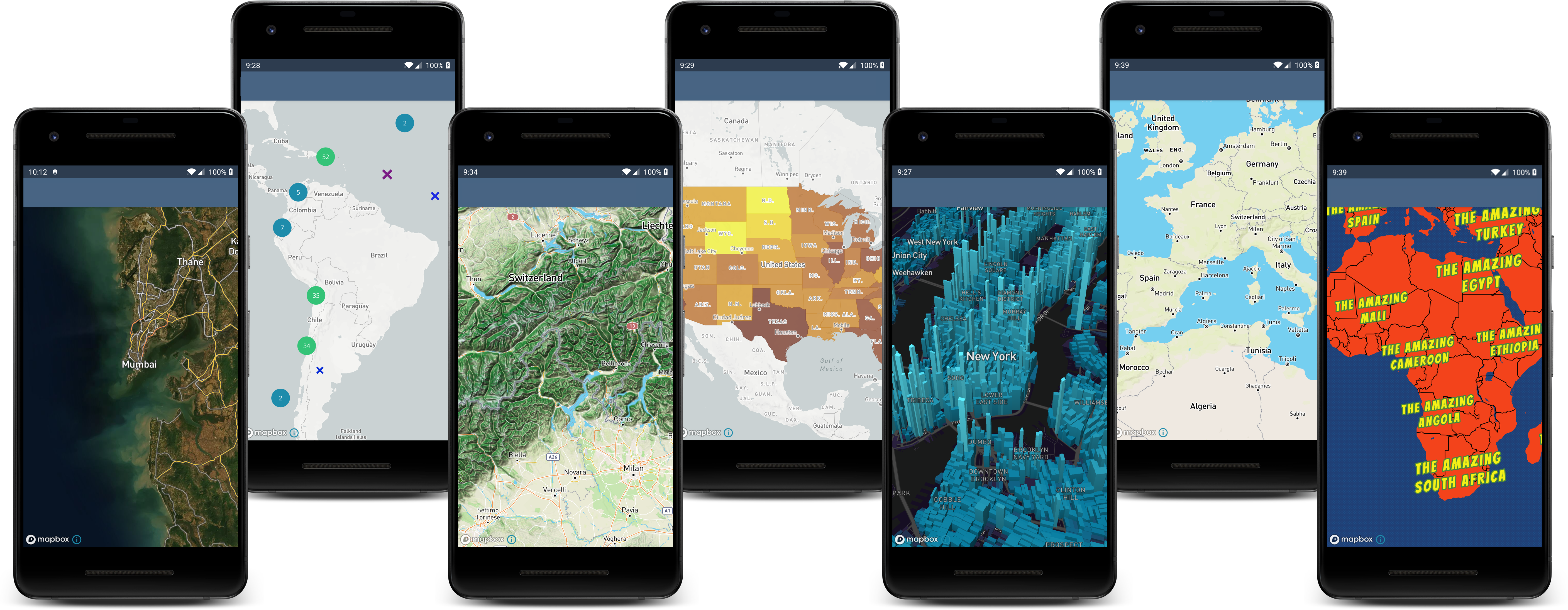
Screenshots


Setup
1. Provide the gradle dependency
Add it in your root build.gradle at the end of repositories:
allprojects {
	repositories {
		...
		maven { url "https://jitpack.io" }
	}
}
Add the dependency:
dependencies {
	compile 'com.github.bkhezry:ExtraMapUtils:v1.2.0'
}
2. Add your code
add MapView to UI layout
"><com.google.android.gms.maps.MapView android:id="@+id/mapLite" android:name="com.google.android.gms.maps.MapFragment" android:layout_width="match_parent" android:layout_height="300dp" app:liteMode="true" app:mapType="normal" />
new ViewOptionBuilder()
	.withStyleName(ViewOption.StyleDef.RETRO)
	.withCenterCoordinates(new LatLng(35.6892, 51.3890))
	.withMarkers(AppUtils.getListExtraMarker())
	.withPolygons(
		AppUtils.getPolygon_1()
	)
	.withPolylines(
		AppUtils.getPolyline_2(),
		AppUtils.getPolyline_4()
	)
	.withForceCenterMap(false)
	.build();
after declaring the ViewOption, add this code for showing elements on the MapView
MapUtils.showElements(viewOption, googleMap, getActivity());
ViewOption attributes
| Name | Type | Default | Description |
|---|---|---|---|
| title | String | @NullAble | use in demo as CardView tile |
| centerLatLng | LatLng | @NullAble | center of Map |
| forceCenterMap | boolean | false | force map moving to centerLatLng point |
| mapsZoom | float | 14 | zoom of map when map moving to centerLatLng |
| markers | ExtraMarker | @NullAble | list of ExtraMarker that showing on Map |
| polygons | ExtraPolygon | @NullAble | list of ExtraPolygon that showing on Map |
| polylines | ExtraPolyline | @NullAble | list of ExtraPolyline that showing on Map |
| isListView | boolean | false | when using utils in ListView this parameter should be true. because fixing zoom of bounded map |
| styleName | StyleDef | DEFAULT | style of google map |
declare ExtraMarker
new ExtraMarkerBuilder()
	.setName("Start")
	.setCenter(latLngs_3[0])
	.setIcon(icons_2[0])
	.build()
ExtraMarker attributes
| Name | Type | Default | Description |
|---|---|---|---|
| name | String | @NullAble | label of Marker |
| center | LatLng | @NoneNull | center of Marker |
| icon | int | @NoneNull | icon of marker |
delare ExtraPolygon
new ExtraPolygonBuilder()
	.setPoints(latLngs_1)
	.setzIndex(0)
	.setStrokeWidth(10)
	.setStrokeColor(Color.argb(100, 0, 0, 0))
	.setFillColor(Color.argb(100, 200, 200, 200))
	.build();
ExtraPolygon attributes
| Name | Type | Default | Description |
|---|---|---|---|
| points | LatLang[] | @NoneNull | list of point |
| fillColor | int | none color | color of polygon filling |
| uiOptions | UiOption | @NoneNull | some parameter of polygon |
declare ExtraPolyline
 new ExtraPolylineBuilder()
                .setPoints(latLngs_2)
                .setzIndex(0)
                .setStrokeWidth(10)
                .setStrokeColor(Color.argb(100, 255, 0, 0))
                .build();
ExtraPolyline attributes
| Name | Type | Default | Description |
|---|---|---|---|
| points | LatLang[] | @NoneNull | list of point |
| uiOptions | UiOption | @NoneNull | some parameter of polyline |
UiOption attributes
| Name | Type | Default | Description |
|---|---|---|---|
| strokeColor | int | Color.BLACK | line color |
| strokeWidth | int | 10 | width of line |
| zIndex | int | 0 | zIndex of polyline or polygon |
| strokePattern | StrokePatternDef | Default | stroke pattern of line |
getArea() method in ExtraPolygon return Area of polygon in square meters. getLength method in ExtraPolyline return Length of polyline in meters.
add GeoJson to ViewOption
new ViewOptionBuilder()
	    .withTitle("GeoJson")
	    .withGeoJson(context.getString(R.string.geo_json_url))
	    .withStyleName(ViewOption.StyleDef.DEFAULT)
	    .withGeoJsonEventListener(new onGeoJsonEventListener() {
		@Override
		public void onFeatureClick(Feature feature) {
		    //Do more things.
		}

		@Override
		public void onGeoJsonLoaded(GeoJsonLayer geoJsonLayer) {
		    AppUtils.addColorsToMarkers(geoJsonLayer);
		}
	    })
	    .withIsListView(true)
	    .build();
Todo
- clustering support for markers
- add GeoJson & KML layers to map
- add more demo for mixed elements.
- javadoc
- ...
Developed By
- Behrouz Khezry
- @bkhezry
License
Copyright 2017 Behrouz Khezry

Licensed under the Apache License, Version 2.0 (the "License");
you may not use this file except in compliance with the License.
You may obtain a copy of the License at

   http://www.apache.org/licenses/LICENSE-2.0

Unless required by applicable law or agreed to in writing, software
distributed under the License is distributed on an "AS IS" BASIS,
WITHOUT WARRANTIES OR CONDITIONS OF ANY KIND, either express or implied.
See the License for the specific language governing permissions and
limitations under the License.
 408 Dec 15, 2022
 1.6k Dec 29, 2022

 3.4k Dec 30, 2022
 7 Aug 31, 2022
 1 Jun 24, 2022

 85 Dec 28, 2022

 4.3k Dec 31, 2022
 21 Nov 14, 2022
 247 Dec 27, 2022

 7 Jul 30, 2022
 1.8k Dec 4, 2022
 6 Dec 3, 2022
 63 Mar 7, 2021
 87 Sep 18, 2022
 970 Dec 15, 2022
 61 Sep 17, 2022
 34 Nov 7, 2022
 25 Oct 2, 2022
 2 Feb 6, 2022